e.Nova Aerospace

Astra Project

Astra Project

"Protecting skies and seas"

WHAT IS THE MAIN GOAL ?

The Astra Project, officially known as the “Air and Sea Traffic Risk Avoidance Model,” is an innovative initiative focused on developing advanced models to assess and mitigate the risks posed by space debris during launches and re-entries failures. Its main goal is to create sophisticated tools that predict and minimize the dangers space debris presents to air and sea traffic. This debris can result from failed launches, or the natural decay of satellites and rockets.

By providing robust tools for modeling and analyzing fragmentation and explosion scenarios, Astra aims to enhance safety and protect critical infrastructure. Through some research, the project seeks to deliver essential solutions for managing risks associated with space debris, ensuring a safer environment for both aviation and maritime operations.

space debris in space
0 M+

Space debris is a growing challenge in orbit, with thousands of fragments from disintegrated satellites and collisions. This debris threatens the safety of space missions and requires management strategies to protect orbital infrastructures.

8 Figure Settlements
0 M+
Arbitrat Winning Rate
Trials & Arbitrations
0
Ongoing Trials
0 +

Danger Zones

The first project focuses on determining the “Danger Zone,” which evaluates potential debris areas during launches. This involves analyzing various parameters, such as the launcher’s specifications, wind conditions, and atmospheric data. By studying videos and data from launches like Vega, we’ve developed risk assessment tool.

Traffic risks

The second project centers on creating FlyTrack and SeaTrack systems. These tools are designed to assess the risks of collision with air and maritime traffic. By evaluating flight paths and shipping routes, we can identify potential hazards and provide real-time insights into collision risks during space operations.

Final objective

The Astra project uses simulations, like the Columbia shuttle accident, to assess the potential impact of space debris on air traffic. By combining Danger Zone models with FlyTrack and SeaTrack tools, we calculate the overall risk percentage during a launch. This integration enhances safety measures, providing a comprehensive risk assessment to ensure more secure and reliable space operations.

Video illustrations

We have films for each project to illustrate this work. Here are a few playlists you might enjoy

STS-135 Danger Zones

The playlist focuses on the hazardous zones related to the STS-135 mission of the Space Shuttle Atlantis. It features animations and simulations highlighting risk areas during ascent and reentry phases. 


STS-107 CAIB Columbia

This playlist explores the investigation into the Columbia shuttle disaster (STS-107). It includes simulations of debris reentry, radar data analysis, and visualizations of the crash. 


VEGA SSO Tracks

This playlist focuses on the VEGA launch vehicle’s Sun-Synchronous Orbit (SSO) tracks. It features visualizations comparing VEGA’s flight path with data from CNES and highlights potential danger zones during its trajectory. 

You can also be interest in

Back From Space

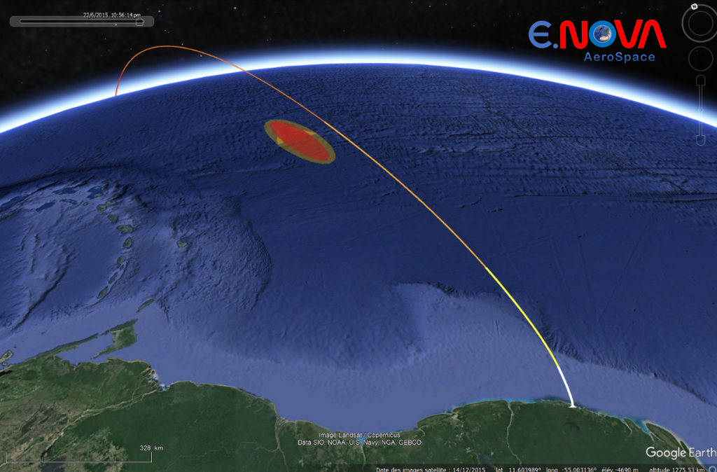
The BFS project develops a safe system for returning scientific payloads from orbit, using advanced thermal protection and tracking for reliable recovery.

Magnus Project

The MAGNUS (Mission Analysis from Ground Users to Space Designers) project is an innovative service initiative aimed at helping companies deploy their services in space.

Some News

For space enthusiasts, we update our news regularly. Take a look and you'll find information on conferences we're attending, articles on rockets, satelites and our personal progress